Bizco Technologies Partners with Geospatial Innovations, Inc. to Bring Custom Utility Vegetation Management Solutions to Market
Clearwater, FL – September 21, 2023 — Bizco Technologies and GeoSpatial Innovations, Inc. (GSI) are now partnered to provide customized software and hardware solutions created for the utility vegetation management market. GSI Forester software will now be bundled with key mobile computing solutions, provided by Bizco Technologies, tailored specifically to the needs of utilities large and small.
The GSI Forester software application, available in Windows, Android and iOS, intuitively manages administrative tasks such as vendor management, budget reporting, and planning workflows. The software also makes map management and site searches easy to navigate through various portals and dashboard settings. Bizco Technologies, is a national VAR that has been building utility-focused solutions for thirty years. Through this partnership, utilities can customize a software and mobile computing solution with affordable leasing options and volume discounts. In addition, access to key contract vehicles, if needed.
“Our team is focused on working with municipality and cooperative utilities, to large investor-owned utilities (IOUs), on building the right solution with unique budgeting options. We use our 30 years of expertise to partner with your vegetation managers to bundle together the right mobility products with the GSI Forester software, from iOS to Android and Windows solutions and from non-rugged to rugged depending on the application. We want to make sure that our customers get the right solution, at the right price, for the ultimate uptime,” said, Paul Zoz, President and CEO, Bizco Technologies.
“We are thrilled to announce our partnership with Bizco to showcase our end-to-end vegetation management solution, GSI Forester. Through this new collaboration, we are now able to provide customers with a complete solution, from hardware to software, wireless and beyond. Bizco’s best-in-class technology allows us to elevate our customer service beyond the competition.” Lisa Livingood, President and CEO, GeoSpatial Innovations, Inc.
For more information, please contact Bizco CMO Danielle Zoz, 402-202-7081, dzoz@bizco.com, or GSI UVM Account Manager Jessica Anundson, 509-844-1057, janundson@gsiworks.com.
About Bizco Technologies Bizco Technologies has been a national solution provider for over 29 years, specializing in Managed IT and AV solutions for small and medium sized businesses to Fortune 500 companies. Bizco is a leader in providing not only a full suite of IT services including network management, voice/data convergence, business continuity and rugged mobile computing, but also fixed and mobile surveillance, audio visual design, installation and services. For more information on how Bizco Technologies can help you, check out our website at www.Bizco.com, email us at gsiworks@bizco.com, or call 888-474-9628.
About GeoSpatial Innovations, Inc. Founded in 1999, GeoSpatial Innovations, Inc. (GSI) is a private, woman-owned software company providing software and services to natural gas & electric companies across North America. GSI delivers industry-leading software to improve productivity and safety for workers engaged in natural gas & electric design and optimization, vegetation management, and GIS implementation services. GSI is a certified Woman-owned Business Enterprise (WBE) by the Women’s Business Enterprise National Council (WBENC). To learn more about GeoSpatial Innovations, Inc., please visit: www.gsiworks.com.
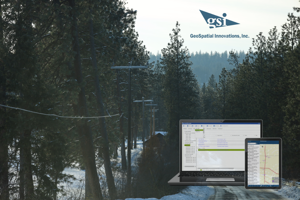
About GSI Forester GSI Forester is an end-to-end map based UVM (Utility Vegetation Management) software solution designed to support UVM operations at electric utility companies. The cloud-based Web Portal allows Supervisors and Foresters to easily create, manage and assign work seamlessly to contractors in the field, while the Field Mobile App gives work planners and tree crews the ability to receive, execute and complete work assigned to them. The mobile app works on iOS, Android and Windows tablets and phones and is designed to be utilized in a disconnected environment, so your data is stored locally on your device until it is synchronized with the database.
Watch our demo of our Forester solution to learn about all the ways we can help you with your Vegetation Management Solutions.
SPEAKER ONE: Anne Beard
My name is Anne Beard, and I’m the director of Vegetation Management Solutions here at GSI, and I really appreciate CEATI for allowing us to speak to you all today about our GSI Forester program. For a little bit of background, I have over 33 years working in the Utility Vegetation Management industry, specifically for utility companies. So for all you utilities out there, I know exactly what you guys need and having sat in that chair for many years. And so I really am excited to bring to you our GSI Forester Solution. Also on the phone or on the line today, we have Max Cunningham. He will be doing the majority of our demo. And Max comes to us from a GIS spatial background. And so he has that technical background for us. And he is going to be demonstrating our product and helping to answer any questions you all may have. So for a little bit of an agenda, I am going to spend a few minutes talking a little bit about GSI and what services and products we offer to the industry. And also introducing GSI Forester Software quickly before we get into the meat of it and the more important thing and why you all are here, I’m sure to learn more about what the software looks like and how it works and how it can simplify your workflows and make your lives easier. So with that, I’m going to go ahead and get started with the slide presentation.
So just a quick company overview for you. Again, I really thank you for the opportunity to present GSI Forrester Software, a product that we’re pretty proud of and can’t wait to show you. Company Overview Quickly. Geospatial Innovations has been around for over 23 years where founded in 1999, we are a women owned, certified by bank diverse supplier. We provide solutions for electric and gas utilities. Our focus is on improving workflow and removing barriers so that Utility Vegetation Management workers can do their job safely and efficiently. We do have a number of technology partners, as you can see across the bottom, where as we gold partner, we work with G.E., Trimble, Hexagon. We are a gold Microsoft partner and we work with our partner Panasonic to deliver hardware solutions as well. We have customers across the United States and in Canada and in Australia. These are just a few of our customers that we serve across the United States. You can see American Electric Power on there, Austin Energy, Madison Gas and Electric, various different sized utilities that we offer. We have a long standing relationship with AEP, providing a number of different software products and services. CenterPoint, FirstEnergy, WC and Duquesne. Some of the software and services that we offer. Obviously, we’re all here to learn about Forester, which is our vegetation management work management solution. It can be easily configured for a variety of contract types, including time and material, unit based, lump sum, etc.. We also offer a product called Distribution Design Studio or DBS, which is an all in one graphic work design tool. As mentioned before, we’re an as we go partner and we help utilities implement and support their GIS systems through our GIS Solutions group. We do custom application development. We have a joint use application storm damage tool and other products. And we also offer utility design services for overhead, underground design work, special projects and again, joint use. But let’s get to the real topic of what we’re here to talk about, and that’s Forrester.
Forrester is a vegetation management planning solution. It’s easily configured as a desktop portal for supervisors, foresters and planners to manage the work with the ability to send the work to a mobile device for vegetation management contractors to record their time and work completed with Forester. You own your own data and you retain a historical record of the work completed on your system. Forester will automate your planning and work execution, auditing and invoicing processes. And there’s no need for use of paper, maps, timesheets or tickets any longer. The setup time for the off the shelf forester product can be done quickly regarding data requiring days and weeks rather than months before go live and Forester is completely configurable to your needs. It is easy to make changes on the fly and I think Max will be just demonstrating that a little bit. In many times. It can be done without the assistance of an internal I.T. group nor from GSI personnel. That said, GSI provides ongoing support and consultation through the design and implementation process as well as after go live.
Some highlights of our forest software. It’s a cloud based GIS software solution. Utility company, as I had indicated, owns their own data. This allows for field planning and management of utility arborist duties across multiple teams and individuals. It can help control costs and improve the productivity of tree crews. We have integrated with many existing software systems across the utility space, including GIS systems, work management systems, customer information systems, outage management systems and invoicing systems. We can easily generate work plans and year end reports, as Max will demonstrate for us. There’s quick start up and integration. We can easily set up forester or environments and you can begin managing your vegetation management workflow within days. We have an administrative tool set that makes configuration changes on the fly. We support the team that works with you throughout the implementation and stays with you and will be your support team after Go Live.
It is available on all platforms, including Windows, client, iOS and Android. And just to give you a quick idea, what that looks like are Forrester or platforms can work on Android and iOS. It can be used with any kind of Android device, like a Panasonic tough pad, Samsung Galaxy tab, a Google Pixel phone. And on iOS, iPhone and iPad devices, users are supervisors are typical users of these types of devices. GSI Forester can be used to view assigned work on top of an A-Z runtime background map. This work can be marked as complete and also equipment usage and time can be tracked for crew members. We also work on Windows Platform, primarily used on devices like Panasonic, MacBooks or Microsoft Surface pros. This offers better field mobility and as opposed to a classic laptop, although those can be used in the field as well. Users are typically of this type of format would be planners or perimeters in the in the field and it offers a robust tool that grants users multiple planning features.
And again, a lot of this is going to be demonstrated here shortly with maps. You create new sites, generate reports, obtain customer signatures. You can attach pictures and documents to the sites which are retained permanently, and you can use a drawing palette to draw attention to certain things on the map for other users to see. And you can reassign work as necessary.
GSI Forester Mobile apps are designed to run offline, only requiring an Internet connection when synchronizing to to the cloud database. We recommend that the synchronization happen at least once a day at the beginning of the workday, and a lot of users also sync at the end of the day. We’ll talk a little bit more about that here with Max. But with that, I think I’m going to go ahead and turn it over to Max to go ahead and start the demo and let me see. Are there any questions before we get started on the demo? No. All right, perfect. If you do, I would go ahead and stick it into the chat and then I’ll try to monitor the chat as we’re going and see if Max can’t answer that question or show you. In answer to your question, but go ahead and take it away. Max, thank you.
SPEAKER: S2 (Max Cunningham)
Okay. Thank you for the introduction. And. My name is Max Cunningham. I am a sales support engineer with GSI. Specifically with the Forrester program. And with that, I will just get right into this. This screen that you’re looking at right now, just to give you kind of an idea of what we’re going to be looking at over the next 20 to 30 minutes is we have an application that works both web based and field based. So right here I’ve got an iOS tablet shown this larger black screen, and next to it I’m casting up from my my cell phone. It’s an Android based phone. Just to give you an idea, as we look at this, what the application would look like from a field perspective. So whether you are utilizing a laptop out in the field as an mentioned or a tablet or you’re just using your phone to use our program and record your information, we’ll get a view of how that looks. The one that I’m not going to demo today is going to be the Windows based field client just because I don’t want to overwhelm. And I think having a tablet view and a phone view and the web portal view is going to be just enough to get us through this quick demo. So I just wanted to show what I have.
Here is what work is assigned to my account within the Forrester program. I’m showing you this because I will create some work and then we will synchronize that up to the tablets and you’ll be able to see both my tablet phone populate with work that has been assigned to me. In that sense, there are permissions and access limits on what information you see. And and if I were not set up as an administrator for this environment, I would not see work that was assigned to another user within the group. With that, I’m going to go ahead and pull up.
This is our forester. Basically, the administration view that we have here, it’s done through a web browser. Any web browser, use a work for you and how how we manage users and access would be through this admin button and then manage users as Anne hit on contrary to a lot of other software programs out there, you don’t need to reach out to us and have us create accounts for your users or delete users that are utilizing it anymore. We leave that up to the administration within your organization. It is as simple as coming in and creating a new user. All you need to do is create a username for them first and last name, email address and then select the roles that you would like them to play within your organization. Of course, the top tier kind of kind of boss view would be the administrator. You have all the capabilities available. The supervisor would be the next tier. You you have the ability to delegate work within a group, but you can’t go in and change the admin details that we’ll look at in just a second. And then the user would be like your your general orbit and the crews out in the field. That work has been assigned to them and they will only be able to view work that is assigned specifically to them. They can’t transfer work or view other individuals work or anything like that. So mostly when we set it up with a company, we will have 1 to 2 administrators, high level, a handful of supervisors, and then the bulk of users would be the forestry user that will just be dealing with work that’s been assigned to them.
So with that, I’m going to go in here to our admin page and this is where initially we will help configure all the details that your organization needs to improve your workflow across the top. Here I’ve got different tabs for work type report project categories, site configuration and vendor configuration as well. Those are pretty self-explanatory. The work types, as you can see from some of these examples, are going to be the specific work detail that is being done aerial saw, work removals, all that fun stuff. And then you have the ability to yourself generate which attributes you would like to collect in reference to each one of these individual work types. Not all of them are the same. There’s going to be different details. The details that you would wish to capture with a removal are not necessarily going to be the same details that you wish to capture with a herbicide spray, for example. And as she hit on, we we set this up in a way to where the the administrators from an organization can handle making all these changes. Just to show an example of that, right now, we’re going to work here in a little bit with a removal of an elm tree. And as you can see, I do not have elm in here is a pre-populated choice. So I will go ahead and add that in. And then now you can see I’ve got an elm tree in here and we’ll be able to save that and use that further down the line.
Reports just briefly, we can work with your team to configure reports based on really what whatever details that you capture that you would like to see. We’ve got invoicing, reports, cost invoicing, reports, daily invoice purchase, order manifest. I really would do whatever it is that you’d like to report. You can work with our team to configure that within the system. Some of the reports draw from an entire program level. Some draw specifically from a work packet or a site. Just to kind of clarify what I say. Work packet, that would be. It’d be we’ll look at one today that’s kind of a geographic area of a circuit so you can have a work packet. And inside that work packet you will have sites, sites or what we refer to as individual work that is being done and the details of that are being recorded to it. So you can have a work packet and a zip code and a site would be a specific address and owner that a tree was removed, a tree was trimmed along the line. So if there’s any confusion when I’m using some of those words, I will try to keep an eye on the chat. And I know Anne can can certainly chime in at all, but that’s that’s kind of some of the terminology that you’re going to hear in a little bit. The rest of this project categories is going to be if it’s full circuit trade or if it’s hazard tree removal. If you want to keep track of a particular storm coming through and you need to record all work done because of that storm, you can create your project category of storm and then you can again designate what attributes you would like to capture. You can mandate some to be answered or some can be optional. That is completely up to you, and all those details are able to be handled by your organization without having to reach out to us to help configure those details.
A big thing that we we get a lot of notice for is that, as you can imagine, a lot of these details could be cumbersome to to input for every specific project you would like to have the option of working with. So if you have it set up and you know that another project you want to collect similar attributes, you can just simply copy and rename that. So you don’t have to individually go in and and configure this all the time. You can just copy and paste it basically. Same for site configuration. These are the details to a specific site that you will see when you are inputting information again, you can copy and paste them, create, make them mandatory, make them optional, and populate some with with choices, pre-populated choices, just like I did with the species earlier and adding the elm. So with that, let’s see, I got one last here.
The vendor configuration. We allow you to set this up with details and contract information from any number of vendors that you’re utilizing. You just add a vendor and insert a contract and then put the date that that contract is valid. If you get within a month of one contract ending and you’ve already negotiated the next year of a contract, you can go ahead and insert that information, set the dates to where it will switch over automatically when the date comes about. Just for an example here, I’ve got this vendor Xylem in here and they have a contract just to show most people wouldn’t wouldn’t address it like this. But you can do your labor, cost your your time and you can do your equipment or you can do a unit cost like right here to where maybe you don’t necessarily care to collect time and equipment, but if you do a removal. Then you are able to just automatically have the cost populate and based on all the details and again, it’s as easy as coming in here and editing whatever you would like to apply to that your cost. You can break up your removals based on your DBA, and that’s just all again, y’all.
The customer can do it on their own without any reaching out to our team. So that’s how the vendor work is is added in here. And we’ll see some some chances of using it here in a little bit. So now I’ve left the admin portal where all the configuration is done and I’m in the main bulk of where we see kind of our table of contents that we’re working with, the specific cycles that we’re going through, the projects and then ultimately the, the work packet and the sites you’ll see here that I have this demo set up on a four year cycle. So for this year, one of four that we’re working with, I have projects in here that deal with herbicide application hazard tree removal and full circuit trim, which, which I’m just using as your general day to day going and addressing any work that needs to be done down the circuit. And we have the ability to control prioritization within this this project level right now. It’s set up to be the project level. If it. If it’s requested and there’s a need for it that can be done at different levels within the workflow as well. But this one is set up to just be at the project level.
So if you have a again, a storm come through and you want to address that, you can make that your top priority versus just your regular day to day work or your herbicide applications and making those changes at that level or as simple as just coming in and editing that. So I’m going to change this circuit, just our regular circuit trim to top priority. And at the same time, I can go ahead and assign a vendor to to be the individual company that is doing the work that’s assigned underneath this project. And then since. So we’ll just go ahead and move there. You see that my changes have been made. The next tab that I have, is this my crews. So again, this is just in relation to a vendor. You can have a vendor name that has any number of crews working underneath them. You can see what this example we have. I have two crews here. This just is an example to show you can based on their user level, if they are the crew foreman, they have the ability to add people in their crew removal from the crew. Or if you have, you don’t necessarily have to have all of the individuals within a crew with access to the system. But you might still want to record their time for the work that they’re doing. So they’re not going to be on their phone collecting any information, but you can still charge hours against them and record them using equipment or record them doing work without them having to be a user of the program. This is our next tab and this is where we get into the actual details of of an individual work packet and then ultimately the sites as well. Again, this stems back to what you saw when I showed right here the the tablet and the phone, the only out of all these items as Max Cunningham, the owner of one. And that was the reason that we saw only one of those if we are acting like an beard is the forester for the company and she has created this work packet for me, assigned me a portion of a circuit to work on, and she is ready to assign it to me as the planner to go out and actually walk in the field. And before work is done, go ahead and keep track of what needs to be done. This is where you’ll see. I’ll get an error now because I’m not an beard. So if you try to assign work that you’re not the owner of, it will not let you unless you are an admin like I am. So I can come in here and just override that. I can go ahead and change. The owner to Max Cunningham. And we you have the ability to control the status as you want to go again. You can you can change these levels, whatever you would like to whatever your workflow would require. And you can also make limits on how far you can step. If you want to mandate that they have to go one through one, you can do that if you want to put a limit on saying you can’t go from creative to trimming completed without going through a few steps. You know, that’s that’s more than up to you. I’ll go ahead and just mark this one as planning in progress. So when I I’ll show you in in one second. But for for this demo, just I’ll go ahead and I’m going to create a new work packet just to give us something to look at, in a word. A packet that you’ll be able to see. I can’t type and talk at the same time, apparently. We’ll call it Planning in progress as well. And then out of the the vendor that we selected, I can go ahead and assign the work out to a crew. So we’ve done that. You’ll see now that that has me as the owner of it. See where we’re at here.
So I’m going to go ahead and dig into this this one that Anne has assigned to me as the planner to go out and start planning some work for. For this demo purposes, I have pre-populated a couple of work sites in here and I can I can show those worksites based on the status whether it’s I’ll change that right here. But you can see the color of this polygon, this line and this point have changed now. And we have a legend down here that will notify you of what the current status of these sites is. These were shown to to display that we have the ability to record sites as an X, Y, coordinate as a line or as a polygon. The the x y coordinate would be used. If you’re removing a tree, the line would be handy if you are spraying herbicide down a fence line or something of that sort. And then the polygon is a is a way to track if you’re mowing and you need to keep track of area or something like that. So that’s why I’ve shown you these three in here. Now let’s say that as the planner, I would individually think that this might be a little bit too much work, and I would like to designate that a portion of this work to another work packet to be able to assign to another individual. You can do that within the program here, and I’m just going to grab a portion of this circuit right here and then I can move them to the work packet that we just created. So now again, I’m, I am on both of them. So it, it will look like when I sync up on the tablets here in a minute that I still have both of those. But if you I split those up and then I could go in and I can assign that to another individual and then they would they would get a notification via email saying that work has been assigned to them and then they’ll be able to sync up their device.
So we can see here that this part of the circuit has been assigned and allocated to the new work packet that we have created. Okay. So it’s kind of kind of hitting where the the planning from inside the office would jump to the actual work being done in the field. And with that, I’m going to switch over to the tablet that I’ve got pulled up here. I’m going to be doing most of this stuff in this black tablet just so I’m not going to be doing both of these at the same time. We just wanted to give you an idea of what it looks like with a larger tablet versus someone’s phone that they have. And as you can see, the only difference is shown here are that the phone is in our our light mode and then the tablet is in our dark mode. So we have the ability to put it in dark mode, which if you’re outside and it’s a very bright day, that is a big advantage of being able to see the screen. It’s kind of it can be hard to see see the light mode when you’re outside. So to download again right here, you can see the only work that I had was that initial work packet to go ahead and reach out to the database and collect everything. It’s as simple as clicking up here and then I just need to synchronize, synchronize my device. So that will go ahead and pull the other two work packets that are now assigned to me. You can see them right here. And how how the tablet and the phone work are they have the ability to work disconnected from Internet service. So when you download say if you’re you’re at the house or the office in the morning, you can go ahead and synchronize your device and it will grab all the information that you need and store it locally on your device. And then as you’re out collecting designating sites, inputting time and equipment, or keeping track of work details, that information is stored locally on the device and will continue to store that until you get to service and you’re able to sync up. Really, this is not very large information that you’re gathering from the storage sense. So the only limitations that you will have are going to be how much actual storage you have on your device, which you you can be out there for weeks and weeks at a time and you’re not going to hit multiple gigs of data being stored. So you can be out in the field for a couple of days. If you need to collect all your information, come back in and synchronize up and you’ll, you’ll output the information you collected. And then you’ll also ingest any information that that you have access to seeing that anyone else within your organization has done. See.
So we’ll go ahead and look into this work packet that we created. You can see here, there is the circuit that we designated to this work packet. You’ll see some other information in here as well as as a background sync through. You have the ability to use imagery imagery with labels. I mean, really all of that that it’s up to the user. These background maps you will have to have service for they are as rebased and they are streaming. They’re not stored locally. But you can also see here that we have a grid and then we have some lines down here and then ultimately more information as we dig in deep. The the scale is set to those but however. Your internal GIS has their data. You have the ability to create a map package out of or with what data you would like to have on your device. Download that and again, that is something that is stored locally too. So if your your home base GIS team updates the you get new poles that you need to or the numbering of it changes they can generate in that package and make it accessible for you to download on your device just like you’d see in it. As a scenario, these layers are searchable so you could go in and look for code number X, whatever you’d like to do. Or and you could turn them off. So if you don’t want to see all this stuff, you’re more than able to.
So we are we’re going to make an example of a site right now, and we’re going to act like like I’m the planner again in this in this scenario. And I am out walking and I see a tree that needs to be removed. So I can do that one or two ways I can click physically on the map, or I can have the location services on my tablet, on my phone turned on. And when you click to create a site, it will go off of your actual GPS location. I’m in Houston, this is in Ohio, so we will be clicking on the map right here, but I can click on the map. Would you like to add a new site? We will go ahead and say yes. So that brings up our details that we hit on in the very beginning with the admin information. Everything in here as well as the order that you view, it is up to your administrator and how they want to have it set up. You can have all this information in here. You can make it mandatory. You could have none of it in here. That is completely up to the organization. I’m going to go ahead and create an owner in here. But this is something that with with the adequate GIS information coming from your organization, we can auto populate owner and address information if that information is available. So I’m just going to do this because we will call on this in a minute. So I’ve added my owner information in here. And what we are going to go ahead and do is we are going to say that there is an elm tree that needs to be removed. I can scroll down here to this work details tab right here and then click add at the bottom. And then this is again all pre-populated based on how you set it up in the admin portal.
We will just say we want to do a removal. It’ll pop up with questions that we wanted to be asked. We’re going to come down here. We’re going to say it’s an elm tree. And then I’ll just designate it’s D.H.. And then now you’ve got your work tied in there. If you would like to take a picture of it, maybe you don’t have a lot of confidence in one of your crew members, so he might not know what an elm tree is. And you want to take a picture of the specific elm tree. We can attach photos in here so you can either take the picture with your device or since I’m in a room right now, I’m just going to go ahead and attach one that I have on my device. And then also, if you would like to let whoever is going to be doing the work out here know that there is anything specifically that they need to know. Like if there is a large dog that’s that’s on the property and you want to make sure that your your form of that’s going to come out and do the work and knows about it, then this is how you would do that. We can make an annotation on there. Go ahead and save that and say we’re done. So now we’ve made a note on the map that’s viewable. We’ve attached a picture. We have put the owner information and we have tracked what work needs to be done.
That would be at this point, if you are if I’m the planner and I’m ready to go ahead and hand this off to a crew foreman, I could go ahead and assign this to that crew foreman. He will get an email saying that that work has been assigned to him and then he can sync his device and get all the information that we’ve recorded. We do have some customers that work to spec is how they go about it. So they’re not necessarily planning in advance. They’re more keeping track of the work that they’re doing. If that was the case, then right now is where we could come in and go ahead and record our time and equipment that was done to remove this elm tree. So I’m just here on the timesheet and down at the bottom is where I can go ahead and add that information because I designated this work to accrue already. I know that Ann and Shane both work with this crew, so. And she was busy today. She cut down an entire elm tree. And we’re going to go ahead and charge that out as labor that we had set up in the vendor configuration and it took her 3 hours. So we have that time recorded and then we could say that she used a chainsaw. On that removal. And that again, was 3 hours. So now against this site, we have 3 hours of labor and 3 hours of a chainsaw. See. And one thing I will point out right here, when I look at this, you will see right here next to this removal, the units is all the way up against the left. When you are collecting information just as a regular, regular information work types, you will. This is how this bottom row will look. I point that out because I am about to go into.
What we have is our is our audit mode that way. So I went out and went out, did the work. She can assign it back to me and then I can either verify whether it was done correctly or it needs to be addressed. So how that is done is we can go ahead and edit this packet and I’m going to change it from planning and progress to audit and progress. And that that just triggers a couple of options that are not available unless you’re specifically in the audit. So we can come in here and I will come back to that page and you’ll see now that I’ve got an OC and I’m not OC available. Let’s just say I don’t think she did a great job with the alum. I can click not OC and pull up dialog box to specifically write out what it is that I am failing this for. These are just ones that we have populated. Whatever the organization wants, this box to read is up to them and configurable, or you can come in and manually type something out. But for this purpose, I think she did a good job. So we’ll just go ahead and Mark, that is OC and we can step back. And then we can mark that. Go ahead and change that from audit and progress. To audit completed and then I can assign it back to we can assign it back to and I don’t know, Anne is playing a lot of roles today, but this gives you the, the note right here that if you assign work from your device to somebody else, when you sync up, that work will disappear from your device because it is not yours anymore. So that’s why that’s that’s saying that. And you can see that has now disappeared. Let’s see. So I think we kind of covered most of that.
Again, just to show quickly here on the the phone. It is a little bit less real estate than a tablet that you’re working with, but you can come in here. And again, see, so I have the GPS on my phone, load it up. That’s why it zoomed in down here to Texas. But I could come back in here. And I can go ahead and create a site. And you see the same details that you saw in the tablet as well, your work type details. So everything is similar. Just the number or how much real estate you have is the only difference. And we’re actually going through some some changes right now to improve the work ability from the phone as we speak. So then that is kind of the entire workflow of creating the work, assigning the work, going out in the field and planning the work, completing the work, and keeping track of the details associated with that work. You’ll see here that if I come back and close this out and then come back into it. Basically I’m just refreshing the page. Well, hang on. First off, I have to synchronize. So now that I’ve synchronized, we’ll see the the removal that we generated right here. And you can see. That if I come in here going into the details of that, we have our removal work detail right here, our owner information, our address, the file attachment. Because there’s the tree that we recorded. It didn’t collect any extended attributes. And my work detail there is your removal right there. Sue. What else did we have to show? If you are looking to generate some of the reports, we have some set up through the Windows Field client that that specifically tie into generating a map. One of those right here if you need to get the signature of the owner, you can create that report and you can walk up and actually have the the owner sign off on the work that was done. As you can see here, we’ve got we’ve got a signature here.
You can do it if you have a laptop with a mouse. We’re working on creating that functionality with our tablets as well. But you can go ahead and take a take a picture of that site and any GIS data that you have loaded with it. Another one would be a forester site report that just again, you can configure the report to really capture whatever information it is that you’re looking to capture. The last thing that I’m going to hit on within this report, because I know we’re running a little close here, is the functionality of our site search. This allows the user to really dig in and search through everything within their individual environment. So I named the owner of that site that we created CEATI for a reason. So I’m going to come in here and search for customer. Customer name. CEATI and I’ll add that and then I can apply and then you’ll see this will pull up the information. So if you have a boss that, that gets a call and says we had an error or we’re getting a call saying we, you know, we tore a fence down last week at this address. You could come in and search either by the owner or the address and then pull up very quickly the information that you need. And then hopefully look and you’ll have an attachment of a picture from your crew when they’re done. That clearly shows that that the fence was possibly damaged before they got there. So that’s just a little functionality that we’ve heard is nice to have. And the last little snippet I’m going to show, this is a dashboard through Power BI. This is what we’re working on developing right now, kind of kind of an add on and an improvement on the reports that we can generate is a kind of up to date dashboard where you can get a very quick overview of the status of everything within your organization. We’ve got expenditure in here is what we’re building out a table for sites completed to date site status as a whole. So we’re going to have this hopefully available soon. And we’re just working on making it as easy for the customers to take over as they can. And I think an after that, I’m just going to go ahead and let you have it.
SPEAKER ONE: Anne Beard
Perfect. Thanks so much, Max. That was a lot of information to squeeze into 30 bucks. But you did you did a stellar job. So just a few parting comments before we take some questions. What what is it that sets GSI apart? We believe that our configurability is is number one. It’s it’s quickly set up and easily configured by an admin within your department. Obviously, we’ll take the time initially upon implementation to make sure it meets all of your needs. But after that, there’s no need to contact I.T or GSI for help. In most cases, changes can be made on the fly. You can manage all your users within the admin portal. The fact that we work in an agile work environment means that we work in these three week what we call sprints. So we are constantly improving. The product updates are pushed out every 3 to 6 months and users are using the most up to date version of the software. We consider user feedback and requests while we prioritize and make improvements and changes to make force or better for everyone, we offer personal service from unsure, highly experienced staff members to serve your needs in a timely manner. We were established, GSI was established again over 23 years ago. So we’re a pretty stable company, and our products have been operating in a very stable manner, serving our customers needs for many, many years. And we’d love to be your partner and help support you and streamline your vegetation management program. So that’s all the information that we had to present today. So with that, I’d like to go ahead and open it up for any questions that you may have about our product. We have a couple of technical experts on the phone as well. So if you have some technical questions about the product and how it works in the background, certainly happy to answer anything that you may have.
Our team had the opportunity to travel to Dallas, TX for the DISTRIBUTECH International 2022 Conference! Every year, DISTRIBUTECH International serves as the leading transmission and distribution event that addresses the technologies used to move electricity from the power plant through the transmission and distribution systems to the meter and inside the home.
During the conference, we had the chance to speak with numerous companies about how GSI provides software and services to achieve engineered simplicity and better workflows. At one panel session, we learned about the trend in the industry toward targeted condition-based maintenance using advanced analytics versus the traditional cycle approach.
It was also great to connect with many of our existing customers and partners who stopped by the booth to say hello and learn about what’s new with GSI.
The conference sessions gave us an opportunity to hear from utilities sharing their successes in many areas such as Resiliency Planning and Preparation, Data-Driven Digital Utilities and Asset Management.
After two years of attending virtual conferences, GSI was so excited to return to in-person events! It’s the perfect opportunity to expand our professional network while getting to spend some time away from the office.
Moving forward, GeoSpatial Innovations is thrilled to attend future in-person conferences to continue developing professional relationships while simultaneously providing organizations with the solutions they need.
GIS software that can map vegetation in specific locations
Imaging solutions including satellite and aerial photography from drones as well as laser-based pulses of Light Detection and Ranging (LIDAR) which uses light to visualize areas of concern more precisely
Smart tools that utilize machine learning and artificial intelligence (ML/AI) to provide predictive analyses that enable proactive and predictive approaches to UVM, helping to prioritize tasks based on a model that projects which areas of vegetation pose the greatest risk
We recently partnered with the experts at Cyclomedia to discuss how our platforms can be used together to pioneer the next generation of Utility Vegetation Management (UVM), while producing immense savings on both time and money spent on manual field data collection.
For over 30 years, Cyclomedia has been making camera developments and innovations to form large-scale systematic visualizations of physical environments from their specialized technology capable of collecting 360˚ spherical imagery from a moving vehicle.
At GeoSpatial Innovations, our focus is on improving workflow. By combining the strengths of LiDAR imagery and GSI Forester solutions, we can create immersive 3D digital models of network and site conditions with unmatched accuracy, providing the user with precise, on-demand data and while reducing the cost and amount of potential risk within your current UVM process.
Are you interested in learning more about the value of our Integrated UVM Solution?
GSI recognized for expertise with electric utilities and Esri’s ArcGIS Utility Network
Washington, PA – March 14, 2022 — GeoSpatial Innovations, Inc. (GSI), a private, woman-owned software company providing software and services to natural gas & electric companies across North America, has earned Esri’s Utility Network Management Specialty with an Electric Utilities Product sub-specialty designation. The recognition comes as a result of GSI’s expertise with electric utilities and their successful implementation of software products and GIS solutions with Esri’s ArcGIS Utility Network.
Esri is the global leader in location intelligence providing innovative technological solutions and expertise for more than 50 years. Partners in its Utility Network Management Specialty are recognized for their knowledge and expertise in the utilities market and for delivering solutions and services.
“Esri’s Utility Network Management Specialty recognizes partners who can demonstrate expertise integrating software products with Esri’s ArcGIS Utility Network,” said Lisa Livingood, CEO & President, GSI. “We look forward to exceeding the high bar set by Esri.”
GSI provides design and engineering solutions through products such as Distribution Design Studio and helps energy companies implement and maintain GIS systems, including Esri administration and development. The company develops applications to support and streamline utility business processes such as storm damage assessment, pole inspection, ADMS integration, joint use attachment, asset inspection, vegetation management, and streetlight management, and provides utility design services.
“At Esri we thoroughly vet each of our partners to ensure they meet the high standards we have set since implementing the Utility Network Specialty in the Esri Partner Network program,” Kevin Kirk, Manager, Esri. “GSI is the kind of partner we are looking for, their technical expertise and successful integration between our core products with their robust design solutions make them the perfect addition to our Utility Network Management Specialty.”
Esri, the global market leader in geographic information system (GIS) software, location intelligence, and mapping, helps customers unlock the full potential of data to improve operational and business results. Founded in 1969 in Redlands, California, USA, Esri software is deployed in more than 350,000 organizations globally and in over 200,000 institutions in the Americas, Asia and the Pacific, Europe, Africa, and the Middle East, including Fortune 500 companies, government agencies, nonprofits, and universities. Esri has regional offices, international distributors, and partners providing local support in over 100 countries on six continents. With its pioneering commitment to geospatial information technology, Esri engineers the most innovative solutions for digital transformation, the Internet of Things (IoT), and advanced analytics. Visit us at esri.com.
About GeoSpatial Innovations, Inc.
Founded in 1999, GeoSpatial Innovations, Inc. (GSI) is a private, woman-owned software company providing software and services to natural gas & electric companies across North America. GSI delivers industry-leading software to improve productivity and safety for workers engaged in natural gas & electric design and optimization, vegetation management, and GIS implementation services. GSI is a certified Woman-owned Business Enterprise (WBE) by the Women’s Business Enterprise National Council (WBENC). To learn more about GeoSpatial Innovations, Inc., please visit: www.gsiworks.com.
GeoSpatial Innovations, Inc. (GSI) announced today Anne Beard has joined the organization as Director of Vegetation Management Solutions. Beard brings more than 30 years of experience to GSI, spearheading vegetation management programs for leading utility companies.
The XCELERATE program helps GeoSpatial Innovations, Inc.bring innovative mobile workforce solutions to natural gas and electric companies across North America.
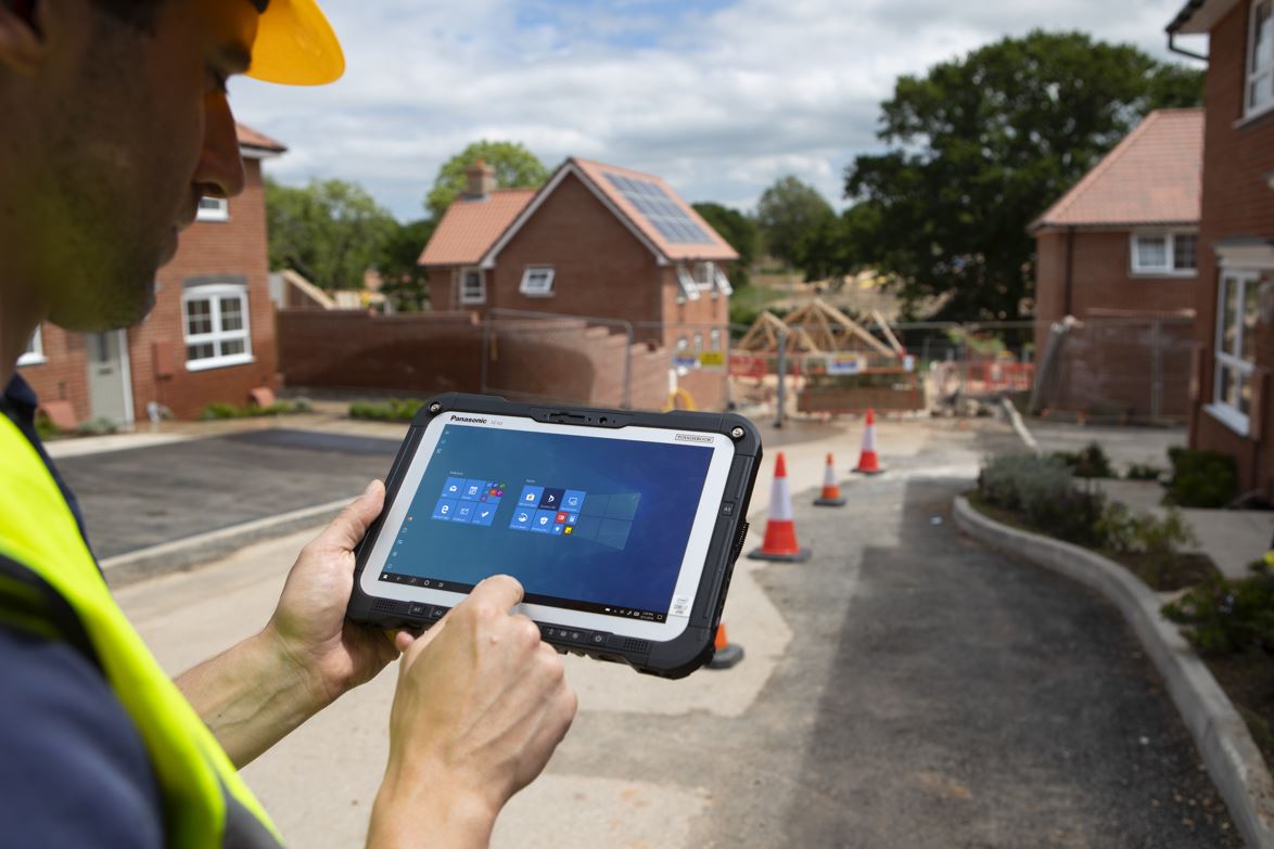
Washington, PA – October 5, 2021 – GeoSpatial Innovations, Inc., today announced its partnership with Panasonic System Solutions Company of North America in joining the company’s XCELERATE Software Application Developer Program for TOUGHBOOK®. The XCELERATE program provides the opportunity for innovative software and solution developers to work closer with Panasonic and its expansive partner ecosystem. Specifically, this partnership delivers customized TOUGHBOOK mobile solutions to organizations in the natural gas and electric utility industry.
With access to industry-leading technology, GeoSpatial Innovations, Inc. broadens its ability to improve productivity for workers engaged in natural gas and electric design and optimization, and vegetation management. It also expands access to GeoSpatial Innovations, Inc’s software tools that aid these organizations with workflow and asset management, and project planning.
“We are excited to participate in the XCELERATE Software Application Developer Program,” said Lisa Livingood, President/CEO at GeoSpatial Innovations, Inc. “By working with Panasonic as a Strategic Partner, we are able to better deliver comprehensive mobile workforce solutions tailored to the needs of our customers while helping utilities save money and maximize efficiency.”
“We are committed to innovating and supporting our partners and customers across all industries, regardless of form factors or operating system,” said Jim Dempsey, director of U.S. business development and partnerships at Panasonic. “As we look at how our customers are using our solutions, it’s critical to ensure that the applications being run on our industry-leading rugged mobile devices gets the job done. For us, this program marks the next iteration of our continued investment in our partners and relationships with the software application developer community to better serve the industries that rely on our support.”
As part of the XCELERATE Software Application Developer Program partners have access to the following services: • Access to SDK and API libraries for simplified and scalable innovation for customers • Technical and engineering support to help facilitate application development and quickly resolve issues • Demonstration units to support initial and ongoing development, testing, and certification, giving customers confidence applications are field-ready • Market strategy support and deployment goals
For more information on the XCELERATE Software Application Developer Program, visit here.
About GeoSpatial Innovations, Inc. Founded in 1999, GeoSpatial Innovations, Inc. (GSI) is a private, woman-owned software company providing software and services to natural gas & electric companies across North America and Australia. GSI delivers industry-leading software to improve productivity and safety for workers engaged in natural gas & electric design and optimization, vegetation management, and GIS implementation services. Our innovative field software uses advanced mobile and GPS/GNSS technologies to help utilities save money and maximize efficiency. Hosted in the cloud or on-premises, our software allows utilities of all sizes – from major investor-owned utilities to rural cooperatives – to make significant improvements in their field workflow. GSI is a certified Woman-owned Business Enterprise (WBE) by the Women’s Business Enterprise National Council (WBENC). To learn more about GeoSpatial Innovations, Inc., please visit: www.gsiworks.com
About XCELERATE Software Application Developer Program The XCELERATE Software Application Developer Program for TOUGHBOOK marks an evolution of Panasonic’s continued investment in the partner ecosystem focusing on the relationships with the software developer community. The program advances Panasonic’s long-standing commitment to innovating and supporting partners and customers across all industries, regardless of form factor or operating system. For ISV partnerships, Panasonic supports a flexible tier-based program that offers partners three options based on their market strategy and goal.
About Panasonic Corporation of North America Newark, NJ-based Panasonic Corporation of North America is committed to creating a better life and a better world by enabling its business-to-business customers through innovations in Sustainable Energy, Immersive Entertainment, Integrated Supply Chains and Mobility Solutions. The company is the principal North American subsidiary of Osaka, Japan-based Panasonic Corporation. One of Interbrand’s Top 100 Best Global Brands of 2020, Panasonic is a leading technology partner and integrator to businesses, government agencies and consumers across the region. Learn more about Panasonic’s ideas and innovations at www.na.panasonic.com/us.
WASHINGTON, PA – December 2, 2020 – GeoSpatial Innovations, Inc. (GSI), a leader in engineering solutions for electric and natural gas distribution companies in North America, has elevated its partnership with Esri to Gold, reflecting the deep integration of Esri technologies throughout GSI’s products and services. The Esri Partner Network is a rich ecosystem of organizations that work together to amplify The Science of Where.
“We are excited that our company has strengthened its strategic partnership with Esri as reflected in the Gold level,” said Lisa Livingood, President/CEO at GSI. “Esri’s Utility Network Model, ArcGIS Runtime, and related spatial technologies allow GSI to bring cutting-edge solutions to our customers in the quickest and most cost-effective manner. GSI is committed to working even more closely with Esri in the months and years ahead.”
“We are pleased to have GeoSpatial Innovations elevate their partnership with Esri by joining the ranks of the partnership community as a Gold Partner,” said Matt Piper, Global Director Industry Solutions: Utilities, Water, AEC & Infrastructure at Esri. “GSI has been a leader in engineering solutions and GIS services for more than 21 years and they have one of the most experienced teams serving electric and natural gas utilities. We are very pleased to expand our relationship with them.”
About Esri
Esri, the global market leader in geographic information systems (GIS), offers the most powerful mapping and spatial analytics technology available. Since 1969, Esri has helped customers unlock the full potential of data to improve operational and business results. Today, Esri software is deployed in more than 350,000 organizations including the world’s largest cities, most national governments, 75 percent of Fortune 500 companies, and more than 7,000 colleges and universities. Esri engineers the most advanced solutions for digital transformation, the Internet of Things (IoT), and location analytics to inform the most authoritative maps in the world. Visit us at www.esri.com/news.
About GeoSpatial Innovations, Inc.
Discover The Power of Field Intelligence™. Founded in 1999, GeoSpatial Innovations, Inc. (GSI) is a private, woman-owned software company providing software and services to natural gas & electric companies across North America. GSI delivers industry-leading software and services to improve productivity and safety for workers engaged in line design and optimization, vegetation management, and Geographic Information Systems. Our innovative field software uses advanced mobile and GPS/GNSS technologies to help utilities save money and maximize efficiency. Hosted in the cloud or on-premises, our software allows utilities of all sizes – from major investor-owned utilities to rural cooperatives – to make significant improvements in their field workflow. GSI is a certified Woman-owned Business Enterprise (WBE) by the Women’s Business Enterprise National Council (WBENC). To learn more about GeoSpatial Innovations, Inc., please visit: www.gsiworks.com or email info@gsiworks.com. LinkedIn: https://www.linkedin.com/company/geospatial-innovations-inc-
After forty years in the utility business, I’ve been involved with every facet of the electric utility operations from generation to transmission and even retail. What I have found is that many professionals in electric utilities do not understand what other parts of the organization do, especially vegetation management. It’s a whole part of the plan and a large part of the budget but what they hear are a whole lot of new terms like side trims, toppers, unit pricing, cycle work, hot spots, demand, fixed price, T&M….
Vegetation Management is an interesting subject as it has a language and culture all its own. Although vegetation management isn’t the mainline business of an electric utility it is a support function that is most critical to the reliable delivery of electricity. We all know that many outages, both momentary and sustained are caused by wind blowing powerlines, touching each other, shorted by a tree branch, or knocked down by a fallen tree. Electric utilities spend a lot of time and in many cases the largest part of their budget in managing the growth and trim of trees. So here is a “Rookie” primer for anyone who is interested in what the vegetation management team is up to.
What’s the process of vegetation management? It’s simple: Identify the trees that need to be cut; send people with tools to cut and clear the trees; record the date that the lines were cleared; come back and do it again when it’s needed. Sounds straight forward, but there are many ways of managing this activity.
The Process:
Let’s look at the process and see what the various influences are. Here are the basic categories in the vegetation management process:
Initiating the Work Request
Requests for tree clearance come from several areas and it depends on the type of work. There are generally two types of work, Planned and Reactive. Each type of work having variations of why the work is done and what the specific need initiated the request.
Planned
As stated earlier, the primary objective is to keep power lines clear of vegetation that can cause an interruption. One type of planned work is the maintenance of the vegetation system. This work is generally planned pruning (or trimming) and is done continuously with each year being part of a multi-year trim cycle. The trim cycle is either approved or directed by the utility commission, or in the case of municipals and coops by local management best practices.
Another approach to managing clearance work is by looking at the circuits that have the highest impact on reliability, “hot spots”, and prioritizing work in that manner. Yet another type of planned work, is that driven by new capital construction. Right of way paths must be cleared based on the new construction needs.
Reactive work
This is work that is done in response to a customer, government agency or dispatch. The most obvious type of reactive work is a trouble request from the dispatcher to clear trees before a restoration effort can begin. Another could be a customer noticing that trees are getting into the power lines. (Note: the customer relationship is a very important part of the clearance management process and we will discuss that in another blog next month).
Executing the work
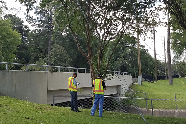
There are two basic ways that utilities are structured for their vegetation work. The first is a basic vegetation management structure as shown in the chart below. A supervisor with several foresters work directly with the contractors (tree and vegetation trimming contractors) to execute the work. The supervisor is probably working on a yearly master plan which is part of that trim cycle that we discussed earlier. Foresters have walked, driven or flown (using LIDAR) the scheduled circuits and identified which areas need to be cleared. They will issue work orders to the contractors and then audit the work to make sure that it was completed properly, before the contractor gets paid.
The second structure (in the illustration below) that I’ve come across is where a planning contractor acts on behalf of the utility by planning and managing the work with the trim contractors.
These are the very basic elements of managing vegetation and line clearance. There are several other aspects that we address in another blog; some of which are customer notification and permission to access property, historical tracking of work, different contract and pricing techniques, compliance with utility commission and regulatory requirements like FAC 003. As you can see vegetation management has many components and much of it is still largely a manual, paper based operation with cabinets full of records which are not easily navigated. Of course, software can help. Looking at the information presented above the software must accommodate several business structures, varying business processes, recording and tracking of both costs and work.
GSI has been engaged in vegetation management since 2009, developing and deploying GSI Forester for electric utilities. The result is one system that facilitates every step of the process from multi-year planning through auditing completed work and updating your GIS, easily managing contractors with convenient, real-time reports and dashboards.
History and Customer
Previously we talked about some concepts that were either directly mentioned or implied. The word “history’ was never mentioned, but to know where you are in the trim cycle you need to know where and when work was previously done. We also mentioned customer and a couple of points are important here. Power lines are often on the right of way through the customer’s property. So, a customer needs to be notified and grant permission for the work. Likewise, if a customer has a complaint there needs to be history verifying that the utility did do work. The customer relationship is very sensitive and complex, especially in “canopied” communities. For an education on this issue I recommend the LinkedIn post “Less is More” by Perry Odom, City of Tallahassee Electric Utility Arborist https://www.linkedin.com/pulse/20140630133724-49180422-less-is-more
Bidding and Costing
An interesting aspect of the vegetation management business is the many ways that contracts are priced
Time and Materials- Usually this means rates are agreed to for every category of labor, equipment and materials. The contractor is just given work orders and executes at those rates.
Unit Pricing- This pricing is based upon the type of work that is done. Examples are lateral cuts, side cuts, application of growth retardants per area of measure, etc.
Firm Bid- Under this scenario prices are bid to include all material equipment and labor to clear a circuit(s) or a region. In this kind of bid the contractors may even have to do a walk (ride) down a circuit to prepare a bid.
Government Regulation
Effective July 1, 2014, The Federal Energy Regulatory Commission (FERC) mandated that all U.S. bulk energy transmission companies comply with the North American Electric Reliability Council (NERC) regulation FAC-003-2 and furthermore requires 100% inspection of all transmission corridors each year.
FAC-003-2 was born out of the cascading 2003 black out around the Great Lakes and Northeast, which was started by a vegetation flash on a bulk transmission line at First Energy. See this Wikipedia discussion https://en.wikipedia.org/wiki/Northeast_blackout_of_2003
Vegetation management programs are still largely manual, paper based operations with cabinets full of records which are not easily navigated. Of course, software can help. Looking at the information presented above it is clear that the software must accommodate several business structures, varying business processes, recording and tracking of both costs and work.
GSI has been engaged in this business since 2009 and the GSI Forester software can enhance any vegetation management program and covers all the scenarios described in this article.
GET THE LATEST NEWS
Subscribe to our newsletter and be the first to know about Forester benefits, updates, and features!
By submitting this form, you are consenting to receive marketing emails from: . You can revoke your consent to receive emails at any time by using the SafeUnsubscribe® link, found at the bottom of every email. Emails are serviced by Constant Contact